On the surface it may look like BP and the Obama administration are having some bad oil days. Rust-colored oil that fouled Louisiana’s ecologically sensitive marshes washed ashore on barrier islands off Alabama and Mississippi on Tuesday.
The oil slick now looms about 7 miles off the Florida coast and changing wind patterns are expected to drive it ever closer. Weathered oil and tar balls could hit the western Panhandle “in a day or two,” said Florida Gov. Charlie Crist.
In response (via Time),
today NOAA announced that 37% of the federal waters of the Gulf were no-fishing zones. That’s nearly 89,000 sq. miles — almost twice the amount of territory restricted as of May 18 — where the sea life is considered potentially too toxic to eat.
Meanwhile yesterday, the Coast Guard’s Thad Allen announced that the saw blade cutting a riser pipe became stuck, temporarily halting the actually fix part of ‘cut and cap’. Though not, unfortunately, halting the flow of oil which has actually increased due to the cutting procedure.
Unfortunately, as bad as these setbacks are, the reality could be much worse.
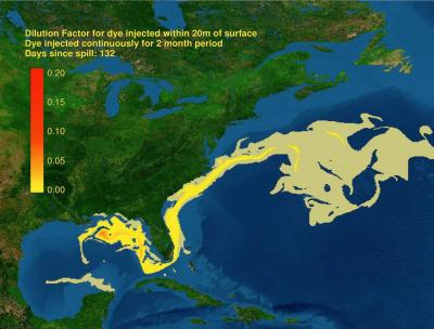
The National Center for Atmospheric Research (NCAR) just released animation of how and where this oil spill may travel based on ocean currents. H/t Mother Jones
We have officially started the 2010 Atlantic hurricane season. It runs from June 1 to November 30 and affect the eastern and Gulf coasts of the U.S. and the Caribbean nations. For the 2010 hurricane season, NOAA is projecting a 70 percent probability of the following ranges:
- 14 to 23 Named Storms (top winds of 39 mph or higher), including:
- 8 to 14 Hurricanes (top winds of 74 mph or higher), of which:
- 3 to 7 could be Major Hurricanes (Category 3, 4 or 5; winds of at least 111 mph)
Which means the August deadline for stopping the spill touted by BP is more likely to be pushed back to the Christmas season (via Bloomberg):
…operations may need to be suspended to allow for an evacuation ahead of a tropical storm or hurricane, during which oil would continue to gush into the Gulf.
Or later, if their first two attempts (BP is drilling them concurrently) at drilling relief wells fail. Of course, then they still have to plug the well.
The so-called relief well being drilled to intercept and plug the damaged well by mid-August might miss — as other emergency wells have done before — requiring more time to make a second, third or fourth try, Dave Rensink, President Elect of the American Association of Petroleum Geologists, said.
And while NOAA points the good news/bad news of hurricanes and oil slicks on their website with the likes of:
The high winds and seas will mix and “weather” the oil which can help accelerate the biodegradation process.
Storms’ surges may carry oil into the coastline and inland as far as the surge reaches. Debris resulting from the hurricane may be contaminated by oil from the Deepwater Horizon incident, but also from other oil releases that may occur during the storm.
NOAA doesn’t mention that a new report (via USA Today) says Underwater oil pipelines extremely vulnerable to hurricanes:
The findings, based on data obtained during Hurricane Ivan’s savage tear across the Gulf of Mexico in 2004, will appear in an upcoming edition of Geophysical Research Letters, a journal of the American Geophysical Union.
The study found that the 31,000 miles of pipelines along the seafloor of the Gulf could crack or rupture unless they are buried or their supporting foundations are built to withstand hurricane-induced currents. “Major oil leaks from damaged pipelines could have irreversible impacts on the ocean environment,” the authors wrote.
Researchers got a unique look at what a hurricane can do underwater during Ivan, a Category-4 hurricane with wind speeds of more than 130 mph in the Gulf. Ivan passed over a network of sensors on the ocean floor.
“This is the first time that anyone measured hurricane-induced stresses on the Gulf bottom,” says study author Bill Teague of the Naval Research Laboratory in Mississippi.
The study’s calculations are the first to show that hurricanes propel underwater currents with enough force to dig up the seabed as far as almost 300 feet below the surface, potentially creating underwater mudslides and damaging pipes and other equipment that rest on the bottom.
The research suggests hurricanes considerably weaker than Ivan could tear up the seafloor.
Which really brings the unresolved questions surrounding the volume of oil into sharp focus. While the current government estimates 12,000 to 19,000 barrels leaking a day and BP has presented 60,000 barrels as a worst case number, one has to wonder if we are still getting the full picture when (via Bloomberg):
In its original exploration plan for the Macondo well about 40-miles from the Louisiana coast, BP estimated the worst-case scenario for an oil spill was 162,000 barrels of crude a day, according to a filing with the U.S. Interior Department’s Minerals Management Service.
And that leads us to the underwater oil plumes that much of the media isn’t talking about, the Obama administration calls “anomalies”, and BP claims it can’t find. This spill is more than 40 days old and yet, it was only yesterday that NOAA sent the Thomas Jefferson to join the Gordon Gunter in investigating the undersea environment. (via Time)
Several independent academic research teams say they’ve found evidence that plumes of oil are forming and moving underwater —perhaps due to the effect of the nearly 1 million gallons of chemical dispersants the energy giant BP has used on the oil, both on the surface and at the wellhead 5,000 feet below.[snip]
University of Georgia scientists — out to sea on a research trip to the oil spill right now — took water samples at the middle depths where the plumes are thought to be and could actually smell and see the oil.[snip]
“The source of reliable information on this has not been the government,” says Ian MacDonald, an oceanographer at Florida State University who has been following the spill since the beginning. “It has been independent academics.”
And (via ABC News) Marine scientists have discovered 3 huge swaths of oil particles in the Gulf of Mexico waters.
…new video showing oil plumes 40 miles out in the ocean, just southwest of the Deepwater Horizon. So far, three large underwater islands of oil have been discovered, some 20 miles long by 6 miles wide.
Kind of makes you wonder what all the dispersants are doing to marine life and wild life. And what it will eventually do to us.
~~~
[Cross posted at No Quarter]
###
